About
Site Directory
Copyright © 2025 www.isleofman.com
All Right Reserved
powered by ![]()
Copyright © 2025 www.isleofman.com
All Right Reserved
powered by ![]()
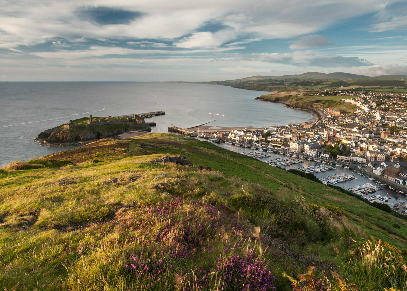
Climbing Peel Hill in the Isle of Man will reward you with stunning views of the west coast of the Island
Peel Hill is located on the south side of Peel along the harbour and rises to 501ft. Access is reached by crossing either of the two bridges across the harbour.
Starting at the hill from Fenella Beach, there are two route options. The first takes you on a steady rise along the spine of the hill towards Corrin's Folly. The second takes you along the back of the hill following an old quarry tramway trail passing the well of St Patrick until you reach the ruins of an old quarry behind Corrin's Folly.
Accessing the hill from the kipper yards area of the harbour is a very steep ascent up the side of the hill, but is also the shortest route to reach Corrin's Folly.
During the ascent views are gained of St Patrick's Isle and Peel Castle, the town of Peel, a wide extent of sea, and a broad belt of the island, with the river Neb, forming a beautiful silvery streak winding in a serpentine course from the hills.
From the summit some magnificent coast scenery is presented, stretching away past Niarbyl Point, as far as the Calf of Man, with the hills of Cronk-na-Irey Lhaa, the Carnanes, and Bradda Head rising sheer out of the ocean, and in one point to a height of 1400 feet. Ascending the summit of the hill in the background are Slieu Whallian and South Barrule.
From here the path may either descend to Peel towards the river Neb, or continue along the cliffs to the little creek where the stream from Glen Maye enters the sea, and then a pleasant walk along the banks of the stream, for ½ mile, to the waterfall.
In books dating back to the 1600's, Peel Hill was named as Horse Hill, with the Horse Rocks jutting into the sea below the Castle walls.
The Giants grave and the ruined fort
In the 1863 Thwaites' Directory, the following passage describes how a fort was erected on the hill by a giants grave:
[From Thwaites' Directory, 1863]
In 1648, the erection of a fort was commenced on the Horse Hill, opposite the castle, in order that any relief brought to the castle in time of the garrison's rebellion or a siege, might be intercepted. Outside the walls of the castle is the Giant's Grave, a green mound about 30 feet in length.
On the hill is the Well of St Patrick, also known in the 1800's as the Silver Well, and so called from an ancient custom of the inhabitants, who there deposited a small piece of silver as an offering; supposedly in ancient times to St Patrick, and in later times to the fairies.
It is said to be the spot where St Patrick first planted the sign of the cross, and at the instant water issued spontaneously out of the rock, and has since continued to flow, endowed with every good to those who come to test its properties. An old author says:-
" Have you beheld when people pray
At Patrick's Well, on Patron's Day?
By charm of priest and miracle
To cure diseases at this well,
The valleys filled with blind and lame,
Who go as limping as they came."
The place is reached by following the old quarry tramway trail along the back of the hill for about 1 mile. Just before arriving at an old ruined building, near the now disused stone quarry, the well is seen close to the path, on the left hand. It is now in such a neglected state that it hardly deserves the name of a well. A little water oozes from the rock, and then flows under the ruins of the tramway path, down into the sea, but there is scarcely any hollow in which it can remain. It is, however, well deserving a visit, for the ocean is seen at the spectator's feet rushing furiously amongst the wild picturesque rocks, and the stranger finds himself pleasantly secluded and surrounded by the sublimities of nature.
References:
Jenkinson's Practical Guide, 1874