About
Site Directory
Copyright © 2025 www.isleofman.com
All Right Reserved
powered by ![]()
Copyright © 2025 www.isleofman.com
All Right Reserved
powered by ![]()
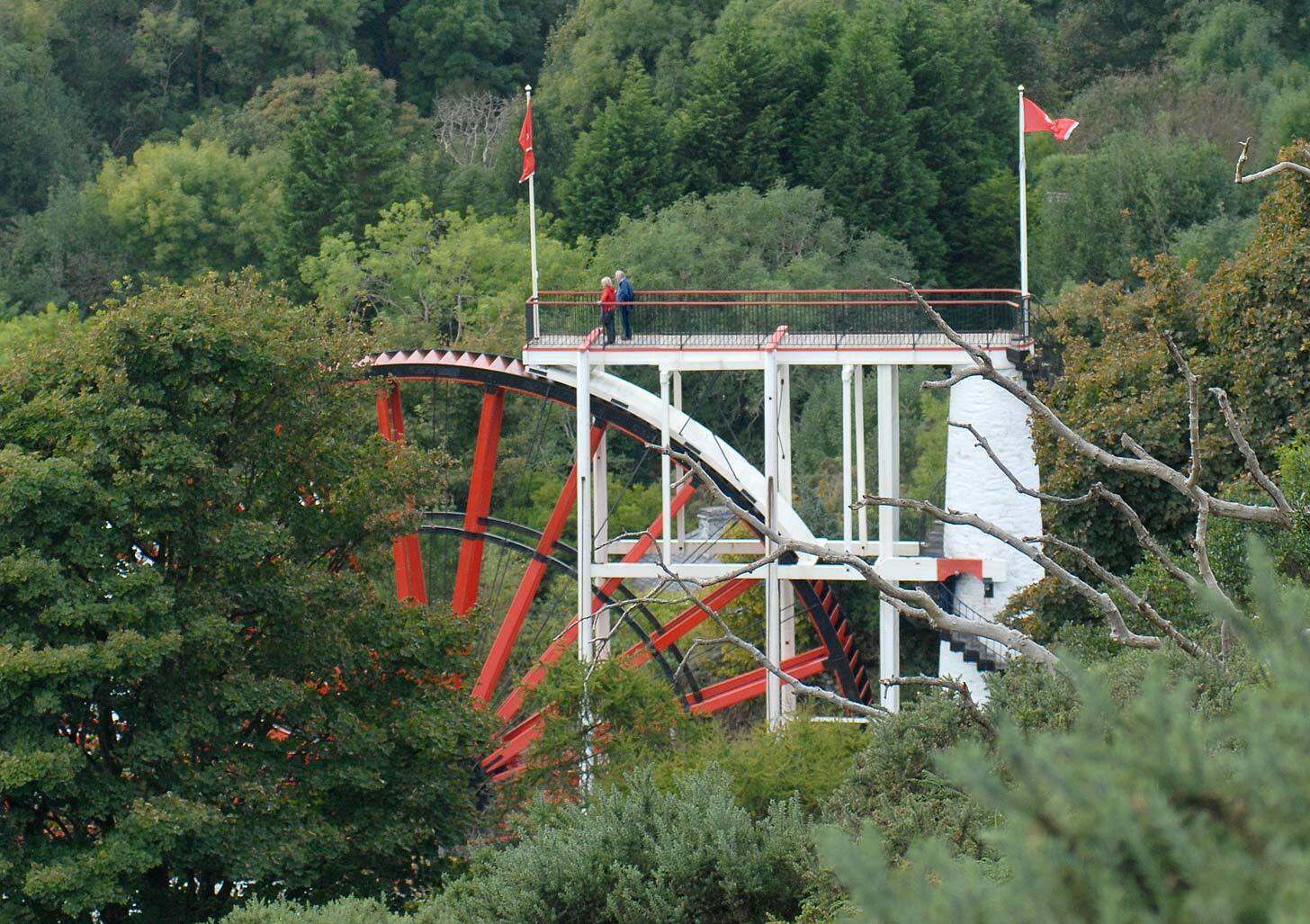
Lonan parish includes the village of Laxey, home to the Lady Isabella water wheel
The parish of Lonan (formerly called Loman, from St Lomanus, a nephew of St Patrick) extends from Port Growdale to Slieau Ouyre, a distance of six miles, and from Carnane Bane, on the east of Pen-y-Phot, to the sea, a distance of over four miles, and covers an area of 15 square miles.
It is an upland district, its western parts being hilly and barren, but its eastern parts, especially in the deep, sheltered glens, are more productive and moderately well cultivated. It contains no point exceeding 1,100 feet. Its coast line is high and rocky, and broken by several headlands and bays. The great headlands are Laxey Head and Clay Head; and the chief openings are Bulgham Bay, Laxey Bay, Garwick and Port Growdale.
The district is pierced from east to west, or rather from NW to SE by several deep depressions - Laxey Glen, famous for its romantic beauty, extending from Snaefell to the sea; Glen Gawne, from the Skoryn to the sea at Garwick; and Growdale from Slieau Meale and Slieau Ree to the sea.
A number of small streams flow down the hills to the sea, the principal of which are the Laxey river and the Glen Gawne river.
This district was partly agricultural and partly mining. The Great Laxey mines, situated at Laxey Glen, the Snaefell mine, at the foot of Snaefell, and other mines employed a large number of work people. The last Laxey mine was closed in 1929.
The village of Laxey possesses a small port at the mouth of the Laxey river.
In this area: